Sistan and Baluchestan
Iran’s biggest province and bordering with Pakistan, Afghanistan and the Oman Sea; it is home to many natural wonders like a 4000 meters high active volcano and the geographical point where broiling desert and sea come together.
Located in the southern-eastern part of the country, Sistan and Baluchestan is currently the biggest province throughout Iran. From the east, the province has long stretches of borders with Pakistan and Afghanistan, and on the south, with Oman Sea and international waters.
Covering such a huge land, it includes various regions such as the indigo plains close to the Oman Sea as well as in the north of the province. The capital of Sistan and Baluchestan is Zahedan and some other important cities are Zabol, Khash, Iranshahr and Chabahar port. Despite being the largest province in Iran, Sistan and Baluchestan is somehow scarcely populated. With only 2.7 million inhabitants, it covers a tiny fraction of the whole population which is more than 80 million. Nearly half of the mentioned population in Sistan and Baluchestan live in villages and rural areas.
Geographically speaking, Sistan and Baluchestan consists of two main contrasting land areas, namely the north of the sound of the province. Sistan is in the north of the province. It is associated with strong winds and also Hamun Lake and Hirmand River which used to flow in from Afghanistan. Another distinct feature of the northern region is the “wind of 120 days”. Throughout the summer this area is hit by strong winds which recently has caused troubles.
However, south of the province, known as Baluchestan is a different story. More mountainous and closer to the ocean, Baluchestan has a more diverse climate. The active Taftan Volcano is also in this region.
This underdeveloped province, has much potential in terms of fisheries, mines as well as agriculture. Close to the Oman Sea, Pakistan and Afghanistan and also the Indian Ocean, this province is considered strategically located as well. But because of its distance from the center and inadequate funding and unskilled workers, Sistan and Baluchestan has fallen behind the rest of Iran. However, with the foundation of modern universities and institution of research as well as launching of new projects, it might catch with the rest of the country and create a better living space for the locals.
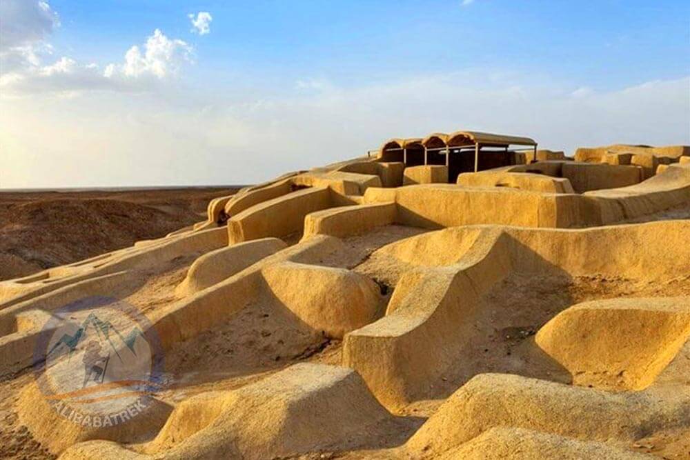
Shahr-e Sukhteh (The Burnt City)
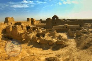
The Burnt City (Shahr-e Sukhte) is an enormous archaeological finding, originally an urban community dating back to the Bronze Age and related to the Jiroft civilization. The Burnt City is considered as the earliest form of multiplex society in the province. Dating back to 3200 BC, Shahr-e Sukhte was thriving up to 1800 BC. It was inscribed on the UNESCO World Heritage List in 2014.
The complex showcases the skills of the ancient people who constructed monuments in the city, had independent and unconnected housing systems, graveyards as well as manufacture. The Burnt City was flourishing until the early 2nd millennium when water became scarce in the region. The residents of Shahr-e Sukhte left the city.
Archaeologists have found houses, graveyard hills, and a good amount of excavated historical artefacts. Happily, because of the dry nature of the desert, Shahr-e Sukhte has perpetuated well. This, in turn, has provided valuable amount of information on the multiplex society of the site.
Kaluts in Lut Desert
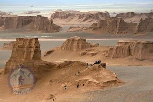
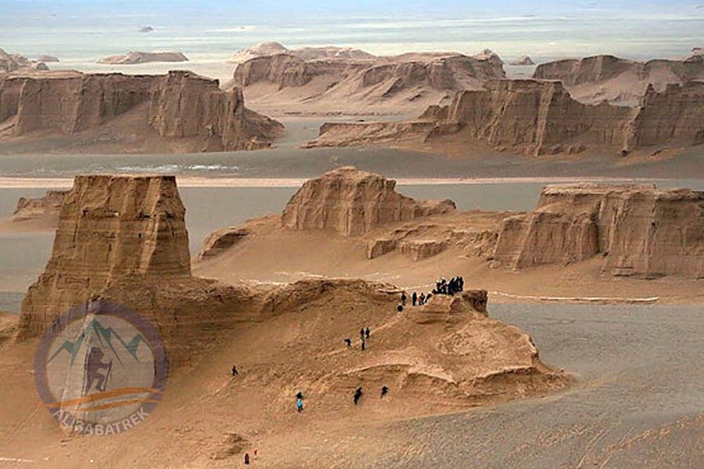
These conspicuous mesas may remind you of Monument Valley in Arizona; there are also tall hills of sand dunes that can replace those in the Arabian countries. Lut desert also has a claim on the world’s hottest recorded place. Based on all these, it is not so difficult to consider Lut as one of the country’s most adventurous sites to visit.
One of the most taken roads is the Shahdad-Nehbandan drive since it showcases the desert’s incredible splendor. This is an asphalt road. However, to go to the sand dunes, you must be driving in a 4wd and a local tour guide. Don’t forget, the day temperature will rise to a nearly unthinkable 65 Celsius degrees in the summer.
Chabahar
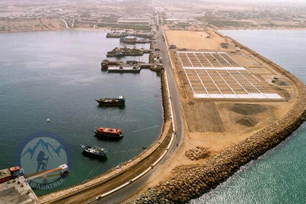
Strategic Chabahar is located close to the international waters of Oman Sea and the Indian Ocean. It is also the best path to arrive at free water for land-locked country located in Asia Center. The city is surrounded by Oman Sea, Pakistan as well as Iranshahr city and Hormozgan province.
Having the typical tropical weather the city has hot and humid summer while its winters are pleasantly warm. Chabahar enjoys the mildest summers among other similar ports in southern Iran, when conversely it is famed for having the most temperate winters.
The word “Chabahar” is said to be comprised of the word “chah” which means “well (for water)” and “bar” which means the area surrounding a place. So people living in Chabahar were those who lived close to the water well which were dug to satisfy the locals drinking needs. However, there’s also another plausible explanation for the name of the city. It might come from the fact that the city has mild climate throughout the year with little change in weather all seasons, so it was called “char” meaning four and “bahar” meaning spring; the city was believed to be always in a state of spring.
According the remnants of history found in a village called Tis, the history of this region goes back at least two millennia and half years ago. When Alexander attacked Persia in the third century BC, the region was called Tiz. And this flourishing commerce remained to be one until the Mongol Invasion of Persia in the 13th century. It also captured by the Portuguese naval army in the 16th century, adding more to the complexity and tragedy of the whole area.
One of top destinations of the region is the Gwadar Bay located on the gulf of Oman. The bay is home to unique Hara forests as well as the exceptionally uncommon Gando crocodile. Some other attractive highlights of Chabahar are the historical Portages Castle, the Baluch Castle, and the Piruz Parthian Castle.
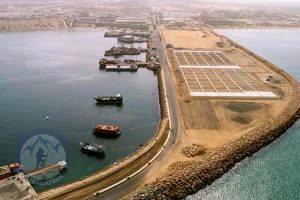
Chabahar is Iran largest port and it has been classified as a Free Industrial and Trade Zone. Its “U”-like port turns Chabahar into an attractive place for scuba divers as well as birdwatchers.
Hamun Lake
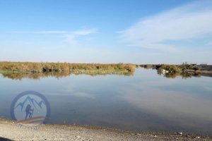
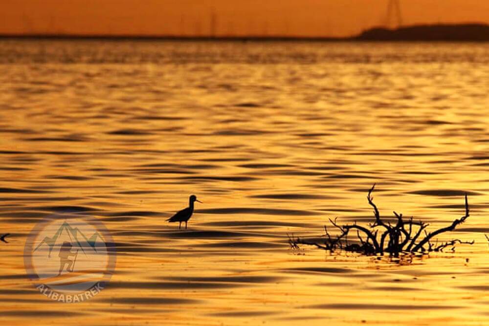
The third largest lake in Iran, after the Caspian and Urmia Lake, Hamun wetlands and lake is the seventh international wetland in the world as is designated as a biosphere reserve in the country. Naturally, Hamun is of high importance when it comes to the lives of the local people. Situated in the Sistan part of the province, it is comprised of three smaller lakes. In times of water wealth, these three small lakes come together to create a huge lake communal lake between Iran and Afghanistan.
Originating from Afghanistan, the Helmand River is the chief artery flowing into Hamun. There are also other local rivers that add to this huge wetland covering more than five thousand and five hundred square km in times of rich precipitation. More than 65 percent of the lake belongs to Iran and the rest to Afghanistan.
However, things get complicated when you consider that Hamun Lake is hugely contingent on Helmand River. Bringing Afghanistan and Iran’s water problems, this contingency has originated many oscillations in water levels of the wetlands. This problem threatens the life and the whole of the ecosystems.
Hamun Lake and wetlands was inscribed on UNESCO a biosphere reserve in 2016, thus, augmenting the number to 12 biosphere reserves in Iran.
The lake has been resisting a major water problem for a quite a bit of time now. Some large parts of the Hamun has dried up and that has led to different biospheric and environmental problems, as well as instigated economic and subsequently social problems in the area.
In 2014, a flood coming from Afghanistan resuscitated Hamun after 15 years of draught. Experts, however, claimed that this is short-lived and that this international lake and wetland is still under the danger of drying up.
Rostam Mountain
Rostam Mountain (or Oshida Mountain or Khajeh Mountain) is located in the northern part of the province, Sistan Plain, and it is 30 km away from Zabol. Oshida Mountain, meaning “eternal”, is considered scared in all three major religions found in the country, Zoroastrianism, Christianity and Islam. Oshida is 610 meters high and is made of an unusual black basalt.
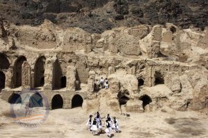
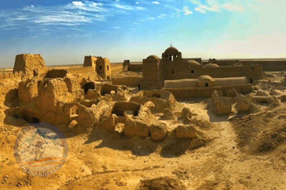
There is also a historical area on the Mountain; there is special urban castle as well as an enormous fortress dating back from Sassanid and Arsacid periods. This historical site is nicknamed “the Mud and Adobe Persepolis” and it’s the sole urban castle that dates back to the Arsacid period in ancient Iran.
There are some ancient sites and remnants coming from Arsacid and Sassanid periods placed on the mountain. Also found there are some Buddhist and Islamic temples. Namely, some of them are: Forty Girls Fortress, Kahak Kahzad Castle, Castle of Sarsang, House of Satan, Gandom-e Beryan building, Ghaltan Khajeh tomb, and other various tombs and Islamic cemeteries.
Castle of Rostam
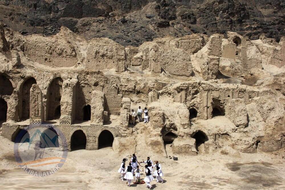
In Sistan and Baluchestan, Castle of Rostam is standing tall, as the biggest of its type, in south-eastern part of Iran. Rostam Castle is situated close to Zabol, and is from the Islamic era.
There highlights of the castle included watchtowers, the impressive entrance getaway, royal court, moat and the private residential region. However, from its many ancient monuments fourteen watchtowers and the entrance getaway now remain. It enjoyed its most glorious days during the Safavid period.
The castle is called Rostam after the heroic figure with the same name of Persian mythology who lived in Sistan and protected the country.
Sistan and Baluchestan Photo Gallery
General Info
- Population: 2,775,014
- Area: 181,785 km2 (70,188 sq mi)
- Elevation:
- Climate: Desert
- Avg. Annual Temperature : 18.2 °C
UNESCO Heritages
- Shahr-e Sukhteh
- Dasht-e Lut

