Yakhar glacier (Yakhar valley) might be the most famous glacier in Iran. Its approximate height is 1300 meters and it continues up to the snow roof below the summit. Yakhar is the highest glacier, and its branches with an altitude of 5000 meters from the sea level are the highest in Iran. This glacier has three main branches:
The main branch (northern-southern)
Eastern branch (eastern-western, it is known as Abbas Jafari branch
The southwest-northeast branch, which is between the main & the east branch. It covers the eastern side of Damavand, and it continues to the altitude of 3700 meters and becomes a secluded valley.
Dobisel (northern side)
A narrower strip extends beyond the height of a 4,000-meter-high float up to the summit. Its gradient is very steep, and there are continuous rock floodings. This glacier is on the northern side of the peak, and its approximate specifications are:
An area of 0.7 sq. Km, an area of 4.6 km, a maximum length of 2 km, an average width of 250 meters and maximum height and minimum of sea level of 5000 meters and 3700 meters.
Yakhchāl-e Sīvaleh
The glacier consists of two relatively distinct pieces. It is extensive from the northern and northwest slopes of Damavand to the north tip of the summit. Its slope is very steep and extends from an approximate altitude of 4,100 meters to the summit. In the summer, rock falls on it very much. Its surface has a high porosity and is black in appearance due to the continuous storms of the summit. This refrigerator is on the north of the peak, and its approximate specifications are:
An area of 1.2 square kilometers, an area of 5.2 kilometers, a maximum length of 2.4 kilometers, an average width of 450 meters and maximum height and minimum sea level of 5000 meters and 3700 meters.
Glacier of dolls
These glaciers disperse at altitudes of 4500 to 5100 meters. The range of these glaciers is limited, and the lengths of each of them are approximately 400 to 500 meters in length. Dolls include eight small and massive glaciers.
West Glacier
These glaciers are scattered from small to large and parallel in various facets of Damavand’s western edge. The largest of them in the north of the Simorgh sanctuary at an altitude of 4300 meters. It continues to the proximity of peaks in the narrow and sloping valleys with the least amount of rockfall. And two smaller fridges next to each other at the height of 4500 to 5000 meters near the northwest edges.
Southeast glacier
This glacier is one of the most demanding, longest, and least extensive Damavand glaciers. It is extending from an approximate height of 4500 meters to the summit. Its average width is between 200 and 300 meters, and its surface appears to be black due to stonefall.
An area of 0.5 sq. Km, an area of 3.6 km, a maximum of 1.7 km, an average width of 300 meters and a maximum and a minimum height of sea level of 4800 meters and 3800 meters.
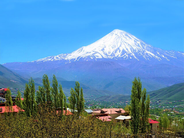
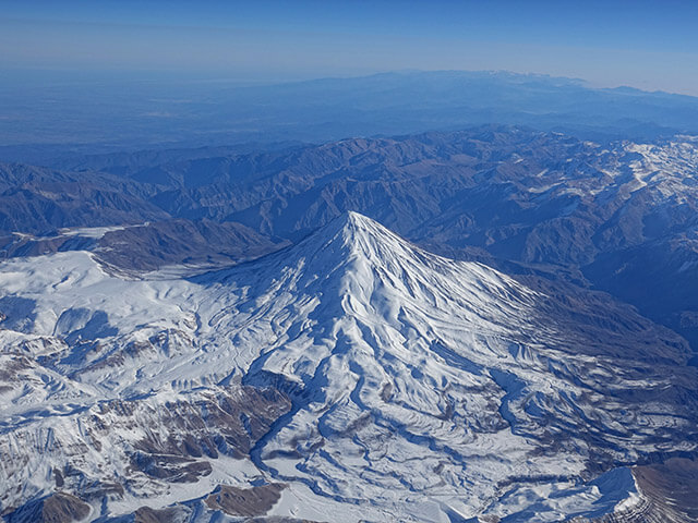
The highest mountain in Iran is Damavand based in Larijan province. Larijan is 60 kilometers northeast of Tehran and 26 kilometers northeast of Damavand town. Damavand was officially known in UNESCO in 2008.
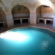
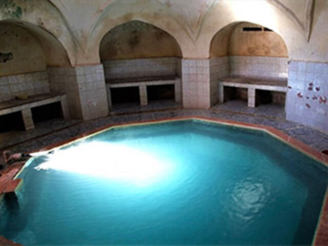
Due to the particular geological conditions, there are many hot springs around Damavand with medical features.
Springs have a temperature higher than the average temperature, in addition to a series of salts in them. This water originates from the depths of the earth and brings minerals to the ground with itself.
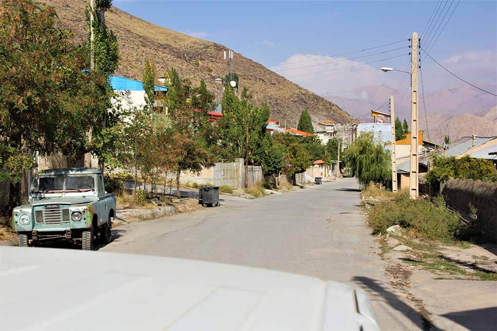
Larijan village
Larijan is in the south of Mazandaran province. Every part of Larijan has rivers and fountains. Springs are separated in different parts of Iran, but most of them are gathered near Damavand and Zagros. Larijan is famous due to its hot springs.
Rineh, Larijan Village
Larijan springs
The amount of water coming out from Larijan fountains is 1000 liters/hour, and its temperature is between 60-70 centigrade. The water tastes awful, and it contains hydrogen sulfide.
From Larijan springs we can refer to Ab-e Ask, Larijan spring, and Astarabku.
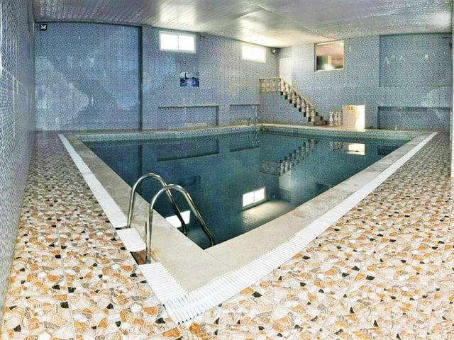
The spa also has health benefits that are beneficial for skin diseases, old ulcers, rheumatism, respiratory system diseases, and neurological disorders.
Almas Shargh Hot Spring Pool
Mountaineering and hot springs
Most of the climbers go to the springs after climbing Damavand to rest and enjoy the boiling water. You can visit Classic Damavand Package.
https://alibabatrek.com/wp-content/uploads/2019/06/alibabatrek-Damavand-Hot-Water-Springs-Damavand-iran-blog-Iran-Tour.jpg246350Y Rhttps://alibabatrek.com/wp-content/uploads/2019/02/Alibabatrek-Iran-tour-operator-iran-tours-iran-travel-agency.pngY R2019-06-03 12:02:412019-06-03 12:18:29Damavand Hot Water Springs
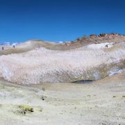
Damavand summit lake is based on its top. It has an altitude of 5610 meters from the sea level, and it is inside the volcanic crater. This lake is almost frozen all year. Due to the hot weather in summer the ice melts. It is one of the freshwater lakes in Iran and due to its height, and frozen nature, people won’t see it that often.
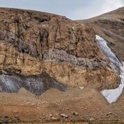
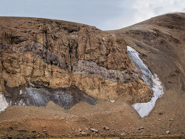
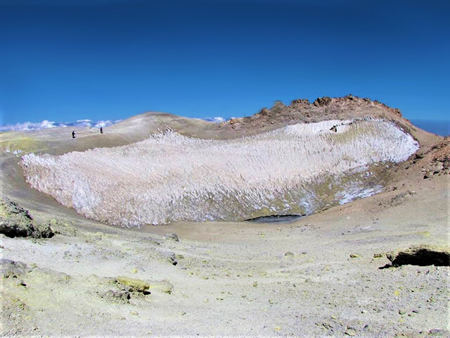
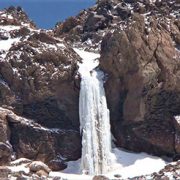
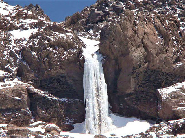
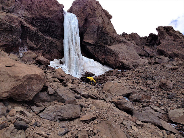
Damavand Frozen Waterfall (5100 m) (Photo: Torkan Shafighfard)
The Frozen waterfall is at the altitude of 5100 meters and on the southern side of Damavand. The height of this waterfall is between 7-12 meters. In summer, due to the heat, there is a thick line of water running in this waterfall. Reaching this waterfall needs to be strayed from the southern route.
Damavand Frozen Waterfall (5100 m)
The frozen waterfall is the highest waterfall in the middle east in the aspect meters above sea level.
This monument is an attraction and a natural sign of Mount Damavand. It has been tryst for mountaineers over all these years. It is a shame that this unique monument has suffered destruction due to global warming.
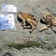
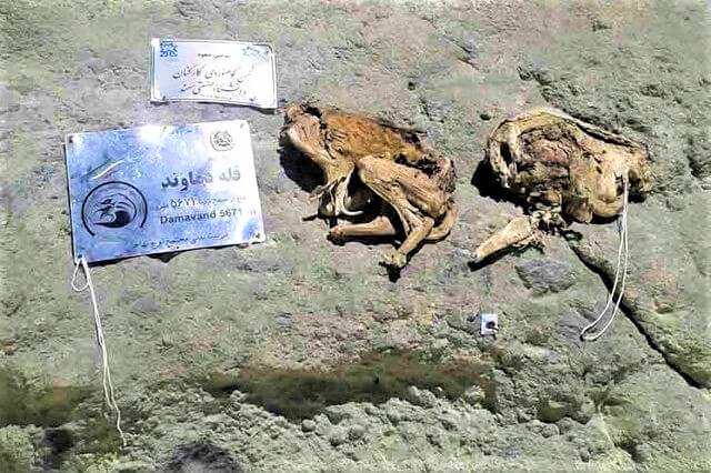
While entering the Damavand summit, where you can see some signs which represents the peak, you can see the corpse of two mammals. They seem to be mummies, and the reason that they are in good condition must be the cold weather and the sulfur. The exact cause of the creation of this corpse is not clear, but they’ve laid there for over 20 years. They must have been part of a pack. They are dead because of the poisoning of sulfur gas of the cold weather. In the past years, some people have destructed this remains. They believed that some animal remains should not present the mountain. But the point is that Damavand is an individual monument and these corpses were just a sign.
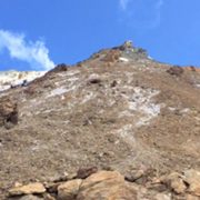
While standing on the third station looking at the Damavand, you’re looking at a 5400m fake summit.
Damavand Fake Summit
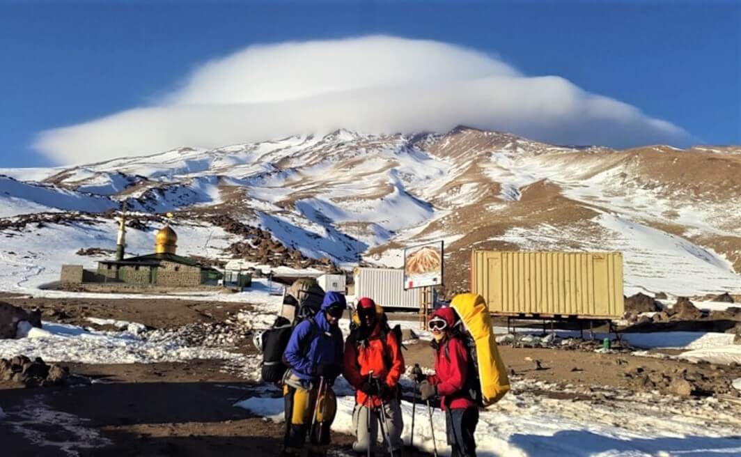
In the hike to Damavand from the southern route, that because of the existence of welfare facilities is the most touristic track to conquer Damavand.
On the hike when we reach the third shelter which is the last camp before the summit, we desire to see the peak. You can’t see the Damavand, and the peak you see is a fake summit with the height of 5400m. It is known as the stony tringle. Upon getting closer to it, we’ll be able to see the real top. Keep it in mind that Damavand is a volcanic mountain.
Looking at Damavand from the fake summit, you can tell the difference in the geological shape of the area. The sulfuric chimnies will be the boldest and noticeable change realizing sulfuric gas leaving behind the yellow chemicals of sulfur on the ground. This area is commonly called the danger zone. From here you’re going to climb a rather gentle slope to the top of the mountain.
Damavand is the first national natural monument in Iran. Also, it’s the highest mountain in Iran, the highest volcano in Asia, and the highest conical mountain in the world.
But what is the exact altitude of this peak? If we want to be a little punctilious, we will doubt Damavand accurate height. Because if we look at pictures and memorials, we will face different numbers.
Damavand in the history
In 744 BC and the Assyrian era, they knew Damavand by the name, Bikeni. Since then, this mythic mountain has always been sacred for Iranians. In the Avesta, the Torah and many other historical texts, Damavand name has been written. Williams Jackson, an American in the 19th century in Tehran, writes:
We know Damavand by the name of Havabarze’iti (هوابرزئیتی) from the Avesta. Many of the tourists and prominent people who entered Iran from Qajar afterward have mentioned Damavand and various altitudes for it from 14,000 to 22,000 feet.
According to the National portal of statistics of Iran, the height of Damavand Mountain from the open water level is 5, 610 meters. The National Mapping Organization of Iran in 2006, during a ten-day project, measured the exact height of the summit. They recorded the number 5609 (five thousand six hundred and nine meters and twenty centimeters) for the peak. After that, the reduced number of 5610 meters was the exact height of Damavand in the resources.
In the past, some different altitudes were known for Mount Damavand. Because of that, you may also have heard the altitude of 5670 meters. But it is not the exact height of the peak.
The relative height of Damavand, which is determined by measuring the height of the peak corresponding to the lowest valley between this summit and the nearest high mountain, is 4,667 meters. This places Damavand in the 12th rank among the highest peaks of the world in terms of relative height.
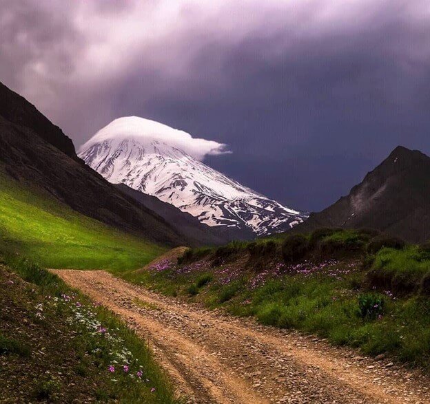
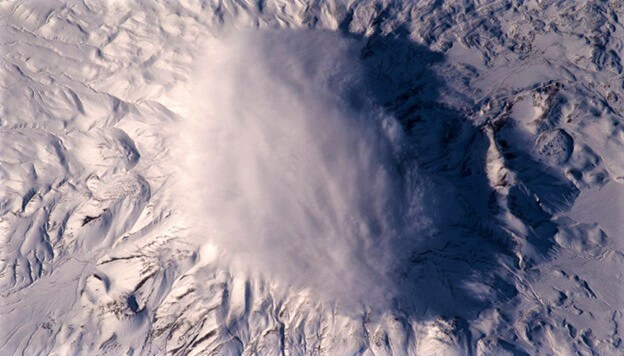
In this picture, you can see the beauty of Damavand Peak with its cloud cap.
How do you think these beautiful clouds appear on the top of high peaks?
Damavand Cloud Cap
Damavand from the International Space Station / French Astronaut
This mountain has a cloudy hat in Iran! Astronauts present at the International Space Station continually cross the Earth. This time, passing through Iran they have taken an impressive image of cloud cover on one of the mountains.
Damavand Cloud Cap
Cloud caps often take shape on the top of the individual mountains. These clouds are floor like and due to the sudden drop in temperature they take form on the high peaks. Temperature drop causes freezing of the humidity in the air. With the Rotational movement of the air around the summit, they appear like a cloud.
scientific analysis
After having an impact with the hillside, the airflow will climb the mountain, due to the altitude increase it will suffer a temperature drop. This process happens in part a-b in the picture below. Due to the air cooling to the new saturation point, the vapor content of the air can not remain in the form of gas. So it becomes very droplets of water or cloud. It’s like what happens to the air that comes out of our mouth in winter. After that, the airflow will continue to reduce energy levels to somewhere around the peak. During this process, condensation energy released by droplets of water increases the temperature of a balloon formed by fine droplets or a cloud of rain. The airflow will fall back to the hillside after reaching the top, due to a reverse reaction its temperature will rise.
Damavand Cloud Cap
This reciprocal flow continues to point c in the picture. As the temperature increase causes the evaporation of clouded droplets and gradually decreases the density of the cloud layers. Despite the fast and robust airflow, the formed cloud will remain on the peak. Two reverse expansion and compression mechanisms on both sides of the mountain caused by the airflows are why the cloud cap has appeared.
https://alibabatrek.com/wp-content/uploads/2019/05/alibabatrek-Volcanic-Seven-Summits-Conquest-Damavand-iran-blog-Iran-Tour.jpg246350Y Rhttps://alibabatrek.com/wp-content/uploads/2019/02/Alibabatrek-Iran-tour-operator-iran-tours-iran-travel-agency.pngY R2019-05-04 10:18:392019-05-07 11:29:46Damavand Cloud Cap
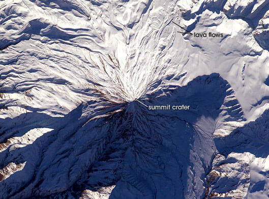
Volcanic craters are consequences of some internal volcanic interactions of the earth. The explosion of magma in the form of pressured gas and lava creates lakes on some of these craters. The size and depth of the volcanic craters may be large.
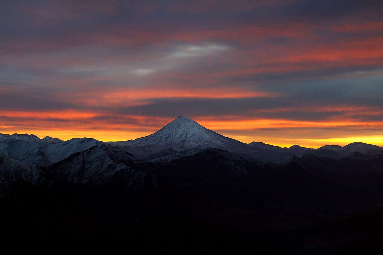
Mt.Damavand (5671m)
Damavand volcano
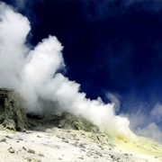
Damavand lava covers an area of about 400 km2. Besides, the newest lava is in the western cone, and there are cones of ash on this domain. Damavand Peak is relatively broad. On the south side and at an altitude of 5100 meters, gases are visible. This place belongs to an old crater, which is surrounded by the present conical summit. On the southeastern side, volcanic mapping takes a broad area.
Mt.Damavand (5671m)
Damavand crater
Damavand is a semi-active volcanic mountain formed mainly during the Quaternary. Its first eruption was about 1/78 million years ago. However, the maximum number of explosions occurred between 600,000 and 280,000 years ago .geologists have an estimated lifetime of this mountain with the carbon-14 method, and it is at least 38,500 years. The presence of several sulfur springs and hot springs is evidence of the half-effect of this volcano. The most significant and most volcanic activity of this mountain occurred about 10,000 years ago, which has led to its formation.
Damavand volcano crater
The crater of the volcano is about 400 meters in diameter. An ice lake has covered The central part of the cavity. On the sidelines, some chimneys make the surrounding land yellow. Apart from the current pit, we can see the evidence of the old crater. One of these old openings is on the south side and at an altitude of 100 meters. It is now the location of the exhaust gases and smoke. On the northern side of Damavand, there is another effect of an old crater of about 9 kilometers in diameter.
“Congratulations! You have successfully reached the summit. Great job! Please take the pictures ASAP cause the weather is getting harsh, and we should descend…”
Mt.Damavand (5671m)
In the Alibabatrek’s Office
I was sitting in the Alibabatrek’s office waiting to meet my new team. The new team consists of 2 German guys and 2 French who wanted to summit mount Damavand.
They were a few minutes late. So, I picked my notebook and started writing the schedule of climbing to the summit. It included the things I should do, the foods and snacks I should buy and the planning for reaching the peak. But then I decided to wait for tourmates to complete my information. Because my experiences have shown me I should be aware of the food habits of my tourmates. I should also know about their physical readiness and write them down in my notebook.
When The Guests Arrived
The doorbell rang; it was the guests. After having tea and cake and some short talks in the conference room, we started discussing the technical tips for climbing. After looking at their body styles and hearing their questions, I got that we won’t have any problems for physical readiness. The only thing that I wasn’t sure about was acclimatization. Well, it has its special techniques. I asked them about the highest height they have ever reached and when it was. The reason I asked them these questions was to arrange a better plan for their acclimatization. I showed them a report plus some photos and videos of Damavand. We also checked out the climbing route together. Then, we checked the weather forecasts for the upcoming days in the mountain and shared all our information.
Then, it was time for checking the equipment and clothes. This way we understood if it was necessary to buy anything. They needed a pair of gloves and a sleeping bag due to the cold weather and climbing season. So, we prepared the things they needed for them. There wasn’t any particular problem with their food habits.
After having a cup of tea in the office, we were on our way to Rineh village near mount Damavand. It takes 2-3 hours from Tehran to Rineh. After arriving at Rineh, we went to a local house which had an amiable atmosphere. I had been in this house a few times before. The owners of the house were a loving family. Reception of the guests had turned into their job.
Near sunset, we went for a walk in the village so that our guests would get to know more of there. We came back to the local house for dinner. They had prepared a traditional meal for us. What a Ghormeh Sabzi! After having dinner, we sat in the yard and chatted while drinking tea and coffee. We also reviewed our climbing plan. Of course, I always act in a way that makes them relaxed and takes the stress away from them.
Rineh Village
Climbing to The Peak
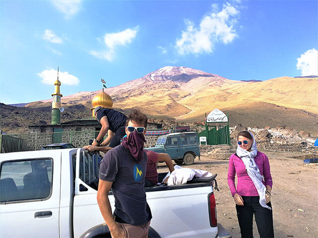
We got up and had breakfast in the morning. Then, we had free time till lunch. So, I told my team that they could have a walk in the village or do other personal stuff. The lunch was very delicious Iranian food, and we enjoyed it very much. We usually care a lot about choosing food that our guests would enjoy. After having lunch, we started going to the camp. In this part, we should get on a jeep. It’s a safe road but has so many bumps and is very shaky!
Damavand Bargah2 (Goosfandsara)
After reaching the camp, we went to our room (which we had reserved before) and put our stuff there. Then I gathered the team and explained some points for them to make them ready for light hiking and acclimatization. It can be beneficial because I can test my team’s abilities. The acclimatization took 4-5 hours and then we came back to the camp. After having dinner, I told my team that they should rest because next morning we will go to the next camp.
We were lucky that the sky was clear and we could see the beautiful sky again. I started looking for the constellations and checking the directions. Doing this is always enjoyable for me, and I wished I could be an astronomer. I do this almost every night that the sky is clear in the mountains.
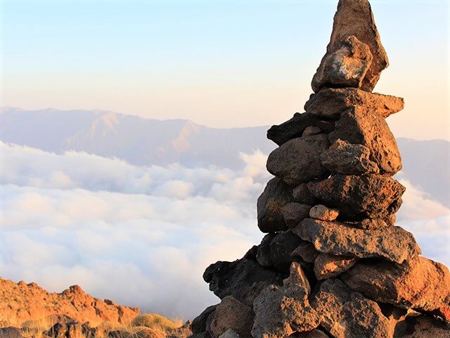
Rock Animals
I woke up a bit earlier than the others in the morning to pack the stuff and deliver them to the porters. Then I made breakfast. As always, I had to argue with the porters. I don’t know why this always happens, and all the guides have this problem with them.
Finally, we started climbing! We can see so many interesting stones and cliffs on our way. I can have fun with them a bit! As a tour leader that has to passes from this path frequently, I have found my hobbies. One of them is these stones that look like animals in specific views. Some of them look in a way as if they are looking at you.
on the way to the hut
We will stop in some places for resting a bit and having snacks. Finally, we will reach the last slope, and the camp appears. After entering the camp, I will show the rooms to the team and give them a short time for resting. Then, I call them over for having lunch. We will go for acclimatization again 2-3 hours after lunch. After coming back, I will prepare dinner and then send the team to their rooms. So they can rest well for next day climbings. Before they go to sleep, I will ask them about how they are. I will immediately take the necessary measures if there is any problem. Typically, nothing significant happens. Except, the body of some of the hikers needs more time for getting adapted to the height.
At the end of the night, I will chat with some of my friends who are mount leaders in other companies. We usually review our memories.
The Sulfur Smoke
I get enthusiastic on the days we are going to reach the summit. The thought that I’m some other person’s guide makes me a bit sleepless. In the morning, I woke up earlier than the others and make breakfast. I will wake anyone who still sleeps so we won’t be late. We will have the last talks before getting to the summit, and then we start going. If we are lucky enough we can see a wild goat flock upper than our camp. I have seen them a few times before and have taken some pictures of them.
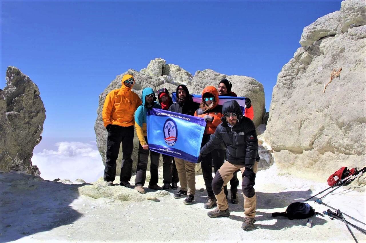
The frozen fountain on our way is the sign that shows we have climbed half of the way. From this point on, everything starts looking a bit different. The shape of glaciers looks like sawtooth; the hills are sulfuric and yellow. And you can smell the sulfur. All these show that Damavand is more than just a regular mount. Near the summit, if the wind blows to our path, we will face the sulfur smoke which can be hurtful. In a few meters to the summit, we can see Damavand’s caldera.” Congratulations! You have reached the summit! Great job!”. These are the sentences I tell my team when they reach the summit. After taking so many photos, we will start going back.
Mt.Damavand’s Summit (5671m)
https://alibabatrek.com/wp-content/uploads/2019/04/alibabatrek-Memories-of-a-Leader-Damavand-iran-blog-Damavand-tour-trekking-Iran-Tour.jpg246350Y Rhttps://alibabatrek.com/wp-content/uploads/2019/02/Alibabatrek-Iran-tour-operator-iran-tours-iran-travel-agency.pngY R2019-04-21 09:54:432019-04-27 10:46:03The Memories of A Damavand Tour Leader